
This post was written in Danish in June 2017. It already carried a machine translation below the Danish original; the duplicate has been removed and the original translated properly.
Preparations for the Pacific Crest Trail have been under way since January, and I am still missing everything – pretty much 🙂 but there will be a post about that too.
Here is a quick overview of the trip.
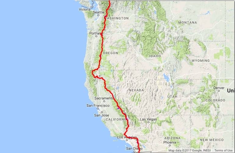
The route runs from Campo in the south, at the Mexican border, and heads north up through the Mojave desert, through the Sierra to Oregon, on through Oregon and Washington, up to the Canadian border. A little trip of 4279 km 🙂
Mount Whitney
Along the way there will be a chance to climb Mount Whitney (4421 m), the highest mountain in the continental USA, which will be quite an experience too, I think.
The first 1100 km are through desert landscape, and since there are not exactly oases of water out there, you have to haul enough water to last a couple of days at a time. But should you come across a small water hole or similar, you have your little device along that can clean the water you find on the way, so you do not end up with a bad stomach or something else nasty.
There are of course a number of towns along the way, which you either pass directly through on the route or choose to walk down to, because you need fresh supplies of food and so on – and you wear out 4-5 pairs of shoes over the whole trip, so there is ample opportunity to upgrade or replace your gear as you go.
After the desert you start coming through greener areas, and at the same time you begin to approach the Sierra.
Bear canisters on the Pacific Crest Trail
From here on it is mandatory to keep all your food in a so-called bear canister, a special container that is impossible for bears to open, and which also stops them smelling the food as much as they would if it were just sitting in your backpack. (one of those is bulky and weighs about 1 kg)
Bears learn very quickly that humans equal food – not in the sense that they eat humans, but they know that where there are humans there is also nice food to steal 🙂
Downhill
After the Sierra it is more or less downhill the rest of the way 😉 almost – it goes up and down constantly, and there are a lot of rivers of meltwater from the mountains to cross. Some have bridges built over them, while for others you have to go through the water to get to the other side.
Oregon is a relatively easy stretch to get through, but is supposed to be incredibly beautiful, since the landscape consists mainly of volcanic rock, so there should be plenty of opportunity for some great star photographs with interesting foreground.
Washington
Washington is up onto the spine of steep mountains, only to go down again on the other side, and it carries on like that for most of the final part of the trip before you cross the border into Canada and find a shuttle bus to the nearest airport.
But depending on how far into September I am at that point, I have a small plan to go to San Francisco or New York and spoil myself with fantastic food and clean new clothes 🙂
If you have any questions, just write 🙂
Here is a map so you can see where the route goes. (it loads a little slowly)
Gear: the full setup I carried on the PCT is on the PCT 2018 gear list.